-40%
New R6 GPS RTK GNSS Mobile station with Fixed station (1 1)
$ 3115.2
- Description
- Size Guide
Description
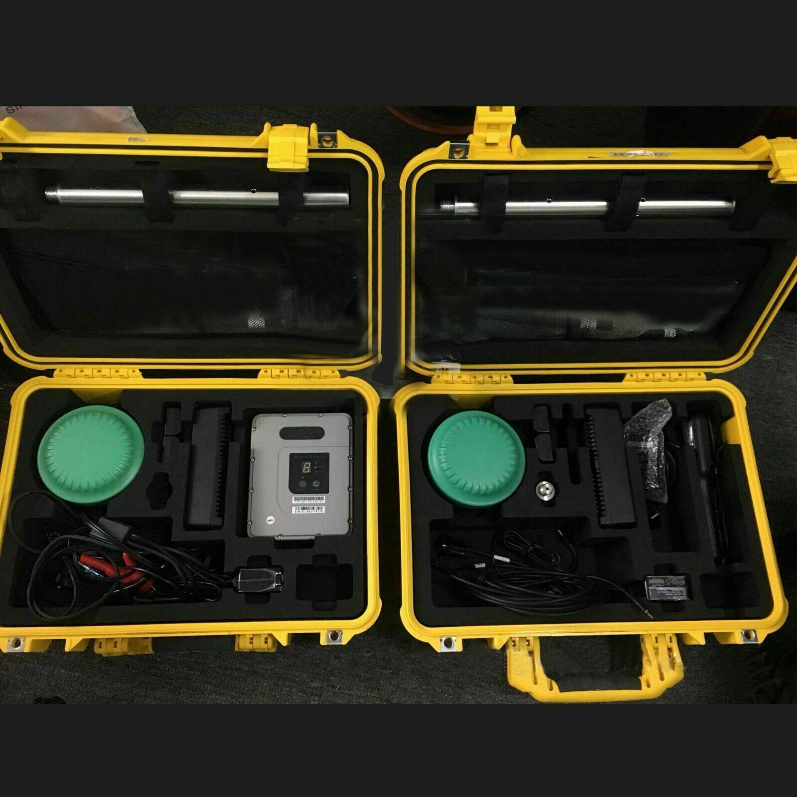
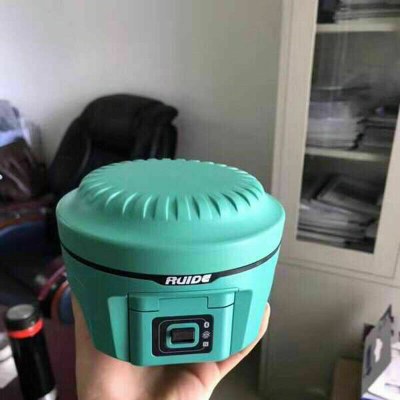
Extremely compact 11.2cm high, 12.9cm in diameter, extremely compact and compact design, weighing only 970g, the smallest and lightest RTK in China, leading the new trend of miniaturization era. Load it lightly and make measurements less burdensome. The new miniaturized RTK measurement system makes the host and luggage more compact, and the weight of the complete set of equipment is 38% lighter than the previous generation. The tough shape design and the stable color matching make the measurement "tall." The compact and lightweight magnesium alloy body is lighter in weight, more resistant to wear and impact, and comprehensively improves the protective performance of the host.Radio communication Full support for mainstream radio communication protocols to achieve interconnection with imported products. The new network program architecture supports multiple network standards and is seamlessly compatible with the CORS system.
Network Bluetooth High-speed network: 4G full Netcom module. The industry's first Bluetooth communication technology, equipped with 4.0 standard dual-mode long-range Bluetooth, can be connected to mainstream mobile phones, tablets and other consumer-grade digital products, at the same time backward compatible with the 2.1 standard, connected to industrial-grade handhelds. Efficient and stable data transmission technology, Bluetooth distance is longer, bringing users a more comfortable working experience.
Tilt measurement (optional) / electronic bubble In the measurement operation, the user does not need to strictly center and then pick the point. The built-in tilt compensator can automatically perform coordinate correction according to the direction and angle of the centering rod tilt to obtain the correct ground coordinates. . Electronic bubbles. When checking whether the alignment rod is level, the user no longer needs to pay attention to the physical bubbles of the alignment rod. The electronic bubble on the handbook measurement software accurately displays the leveling status of the alignment rod in real time.
NFC near field communication: The industry's first to use NFC near field communication technology, with the new handbook, to achieve Bluetooth flash pairing. Get rid of the complicated Bluetooth connection process in the past and connect with a single touch.
Power supply solution Support hot-swappable: dual-battery design, battery and handbook battery are universal, support for rich external charging configuration, battery and handbook battery are universal, field work is more flexible
Intelligent experience Cloud service, NFC touch, smart voice, electronic bubble, tilt measurement (optional).
Configuration detailed indicators
Measurement performance Signal tracking 220 channels Beidou motherboard: 256 channels
BDSB1, B2, B3
GPSL1C / A, L1C, L2C, L2E, L5
GLONASSL1C / A, L1P, L2C / A, L2P, L3
SBASL1C / A, L5 (for SBAS satellites that support L5)
GalileoGIOVE-A and GIOVE-B, E1, E5A, E5B
QZSS, WAAS, MSAS, EGNOS, GAGAN (star station differential)
GNSS characteristics Positioning output frequency 1Hz ~ 50Hz
Initial initialization time is less than 10 seconds
Initialization reliability > 99.99%
Full constellation receiving technology, capable of supporting all current and planned GNSS constellation signals
Highly reliable carrier tracking technology, which greatly improves the carrier accuracy and provides users with high-quality raw observation data
Intelligent dynamic sensitivity positioning technology, adapting to the change of various environments, adapting to the harsher, longer-distance positioning environment
High-precision positioning processing engine
Positioning accuracy Code differential GNSS positioning: Level: 0.25m + 1ppmRMS
Vertical: 0.50m + 1ppmRMS
SBAS differential positioning accuracy: typical <5m3DRMS
Static GNSS measurement: ± (2.5mm + 0.5mm / km × d) (d is the distance between the measured points, km)
Real-time dynamic measurement: ± (8mm + 1mm / km × d) (d is the distance between the measured points, km)
Hardware Size: 12.9cm × 11.2cm, volume 1.02L
Weight: ≤1kg
Material: Magnesium alloy + aviation-grade plastic shell
Temperature: Operating temperature: –45 ° C to + 60 ° C Storage temperature: –55 ° C to + 85 ° C
Humidity: 100% condensation resistant
Protection level: Waterproof: 1m immersion, IP68 dustproof: completely prevent dust from entering, IP68
Anti-vibration: When not working, it will not be damaged when dropped from the 2m high measuring rod to the concrete floor; when working, it can withstand 40G10ms sawtooth wave shock
Electrical Power: 9-25V wide voltage DC design with overvoltage protection
Battery: Two removable lithium batteries, 7.4V, 3400mah
Power consumption: 2W
Battery working time: Single battery life
7h (static mode)
5h (built-in radio base station mode)
6h (mobile station mode)
Communication and data storage I / O port: 5PINLEMO external power interface + RS232
7PINLEMORS232 + USB
1 network / radio data link antenna interface
SIM card slot
Radio modem: built-in transceiver 0.5W / 2W
External transmitting station 5W / 25W
Working frequency 450-470MHz
Communication protocol: TrimTalk450S, TrimMark3, PCCEOT, SOUTH
Cellular mobile: WCDMA3.5G network communication module, compatible with GPRS / EDGE (expandable 4G); CDMA2000 / EVDO3G communication can be customized
Bluetooth: BLEBluetooth4.0 Bluetooth standard, support android, ios system mobile phone connection; Bluetooth2.1 + EDR standard
WIFI: 802.11b / g
NFC wireless communication: Using NFC wireless communication technology, the handbook can be automatically paired with the touch of the host (the handbook also needs to be equipped with NFC wireless communication module)
External communication: optional external GPRS / CDMA dual-mode communication module, free switching, adapt to various working environments
Data storage / transmission: 4GB internal memory, more than 3 years of raw observation data (about 1.4MB / day), based on recording from an average of 14 satellites every 15 seconds. (Can be expanded arbitrarily)
Plug and play USB data transfer method
Data format: Differential data format: CMR +, CMRx, RTCM2.1, RTCM2.3, RTCM3.0, RTCM3.1, RTCM3.2 input and output
GPS output data format: NMEA0183, PJK plane coordinates, binary code, TrimbleGSOF
Network mode support: VRS, FKP, MAC, support NTRIP protocol
Inertial sensing system Tilt measurement: Built-in tilt compensator, which automatically corrects coordinates based on the tilt direction and angle of the centering rod
Electronic bubble: built-in sensor, handbook software can display electronic bubble, check the leveling of the centering rod in real time
User interaction / appearance Keys: One-button operation for visual operation, convenient and quick
Indicator: Three indicators
Voice: Humanized voice prompt
Data link communication Built-in transmitting station: Ruide transceiver integrated built-in station, typical working distance 5Km
Ruide's high-end radio module is assembled with SMT, with high integration and stable radio distance
Network data link: GPRS (optional for 3G / CDMA) network communication module, international universal, automatic login network, compatible with various CORS system access
